Sujet
Map of the Gallipoli Peninsula', 1919.
Légende
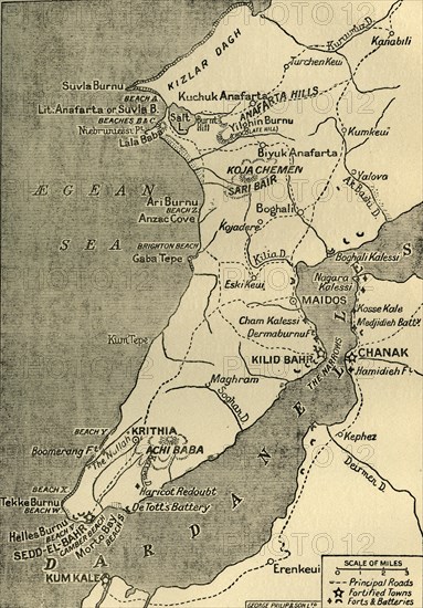
'Map of the Gallipoli Peninsula', 1919. The Gallipoli peninsula in western Turkey saw heavy fighting during the First World War, 1914-1919, with many casualties on both sides. Fortified towns, forts and batteries are indicated. From "The History of the Great European War: its causes and effects", Vol. IV, by W. Stanley Macbean Knight. [Caxton Pulishing Company, Limited, London, 1919]
Date
1919
Crédit
Photo12/Heritage Images/The Print Collector
Notre référence
HRM19F14_469
Model release
Non
Licence
Droits gérés
Format disponible
61,6Mo (8,4Mo) / 32,8cm x 47,0cm / 3876 x 5552 (300dpi)