Sujet
The Dardanelles with its Forts', 1919.
Légende
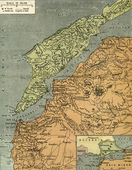
'The Dardanelles with its Forts', 1919. Map of the Turkish coast showing the Gallipoli peninsula which saw heavy fighting during the First World War, 1914-1919, with many casualties on both sides. Forts and batteries are indicated. From "The History of the Great European War: its causes and effects", Vol. IV, by W. Stanley Macbean Knight. [Caxton Pulishing Company, Limited, London, 1919]
Date
1919
Crédit
Photo12/Heritage Images/The Print Collector
Notre référence
HRM19F14_471
Model release
Non
Licence
Droits gérés
Format disponible
63,3Mo (8,2Mo) / 35,1cm x 45,2cm / 4146 x 5337 (300dpi)