Sujet
Map of the Italian Fighting Front', 1919.
Légende
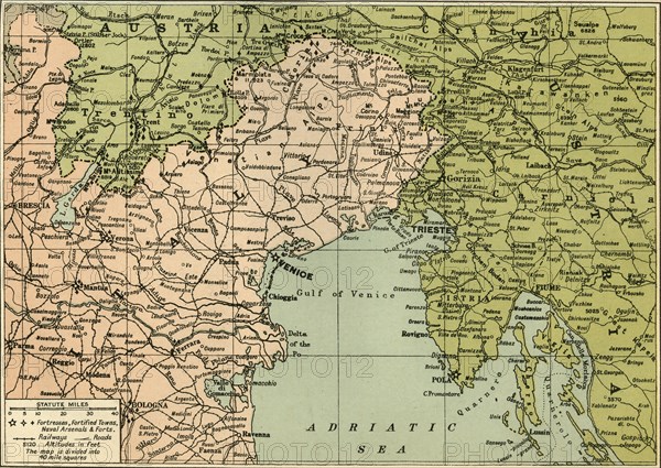
'Map of the Italian Fighting Front', 1919. Map showing north-eastern Italy, the Trentino and part of southern Austria during the First World War, 1914-1919. Fortresses, fortified towns, naval arsenals and forts, railways and roads are indicated. From "The History of the Great European War: its causes and effects", Vol. VI, by W. Stanley Macbean Knight. [Caxton Pulishing Company, Limited, London, 1919]
Date
1919
Crédit
Photo12/Heritage Images/The Print Collector
Notre référence
HRM19F14_475
Model release
Non
Licence
Droits gérés
Format disponible
61,3Mo (7,2Mo) / 46,5cm x 33,0cm / 5496 x 3900 (300dpi)