Sujet
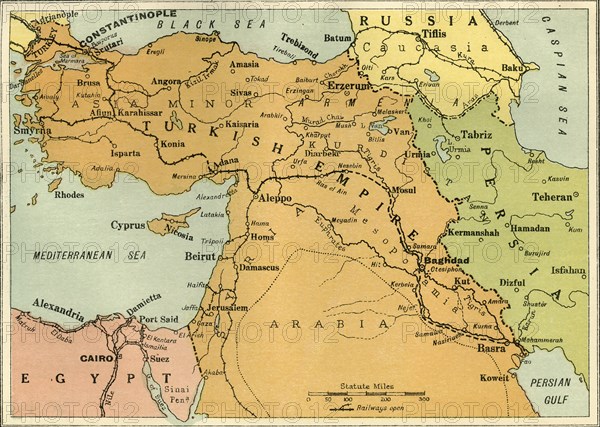
Map to Illustrate the Mesopotamian Expedition', 1919.
Légende
'Map to Illustrate the Mesopotamian Expedition', 1919. Showing the Middle Eastern theatre of World War I, including the Turkish or Ottoman Empire, and parts of Russia, Persia and Egypt. The Mesopotamian campaign was fought between the Allies represented by the British Empire, (Britain, Australia and British India), and the Central Powers, mostly of the Ottoman Empire. From "The History of the Great European War: its causes and effects", Vol. V, by W. Stanley Macbean Knight. [Caxton Pulishing Company, Limited, London, 1919]
Date
1919
Crédit
Photo12/Heritage Images/The Print Collector
Notre référence
HRM19F15_279
Model release
Non
Licence
Droits gérés
Format disponible
62,1Mo (6,3Mo) / 46,7cm x 33,3cm / 5518 x 3935 (300dpi)