Sujet
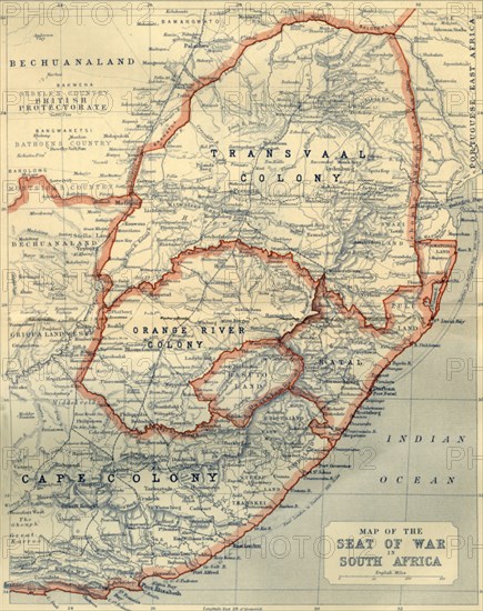
Map of the Seat of War in South Africa', 1901.
Légende
'Map of the Seat of War in South Africa', 1901. Map showing Bechuanaland, Transvaal Colony, Orange River Colony, Natal, Basutoland and Cape Colony, the theatre of war during the Boer Wars (1880-1902), fought between the British and the Boers. From "The Life and Deeds of Earl Roberts, Vol. IV. - To Lord Roberts's Reign in Pall Mall", by J. Maclaren Cobban. [T. C. & E. C. Jack, Edinburgh, 1901]
Date
1901
Crédit
Photo12/Heritage Images/The Print Collector
Notre référence
HRM19F15_466
Model release
Non
Licence
Droits gérés
Format disponible
60,8Mo (3,0Mo) / 34,7cm x 43,8cm / 4104 x 5178 (300dpi)