Sujet
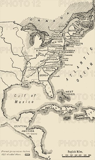
'Map of North America, Illustrating the American War of Independence'
Légende
'Map of North America, Illustrating the American War of Independence', c1785, (1890). The American Revolutionary War (1775-1783) or American War of Independence between Great Britain and its Thirteen Colonies (allied with France) who declared independence in 1776. From "Cassell's Illustrated Universal History, Vol. IV - Modern History", by Edmund Ollier. [Cassell and Company, Limited, London, Paris and Melbourne, 1890]
Date
1785
Crédit
Photo12/Heritage Images/The Print Collector
Notre référence
HRM19F25_004
Model release
Non
Licence
Droits gérés
Format disponible
61,1Mo (2,0Mo) / 30,2cm x 50,7cm / 3563 x 5994 (300dpi)