Sujet
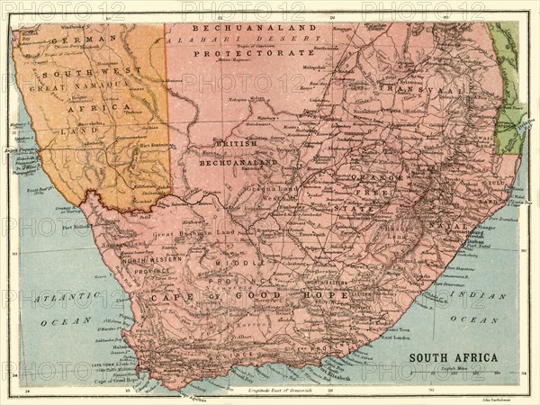
Map of South Africa, c1914, (c1920). Creator: John Bartholomew & Son.
Légende
Map of South Africa, c1914, (c1920). Map of the southern tip of Africa at the start of the First World War, showing German South-West Africa (later Namibia), and various provinces of South Africa including the Bechuanaland Protectorate, Transvaal, Natal, Orange Free State, and Zululand. From "The Great World War - A History" Volume I, edited by Frank A Mumby. [The Gresham Publishing Company Ltd, London, c1920]
Date
1914
Crédit
Photo12/Heritage Images/The Print Collector
Notre référence
HRM19F26_027
Model release
NA
Property release
NA
Licence
Droits gérés
Format disponible
61,2Mo (3,8Mo) / 45,2cm x 33,9cm / 5335 x 4008 (300dpi)