Sujet
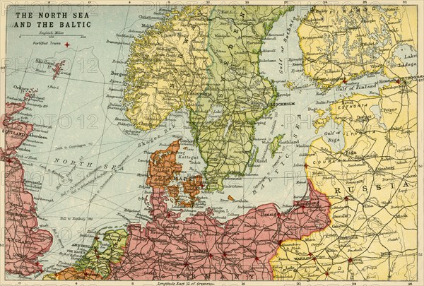
Map of the North Sea and the Baltic, c1914, (c1920). Creator: John Bartholomew & Son.
Légende
Map of the North Sea and the Baltic, c1914, (c1920). Northern Europe at the start of the First World War, including parts of Norway, Sweden, Finland, Russia, Germany, Denmark, Great Britain and Holland. From "The Great World War - A History" Volume II, edited by Frank A Mumby. [The Gresham Publishing Company Ltd, London, c1920]
Date
1914
Crédit
Photo12/Heritage Images/The Print Collector
Notre référence
HRM19F26_030
Model release
NA
Property release
NA
Licence
Droits gérés
Format disponible
61,6Mo (6,2Mo) / 47,8cm x 32,3cm / 5640 x 3816 (300dpi)