Sujet
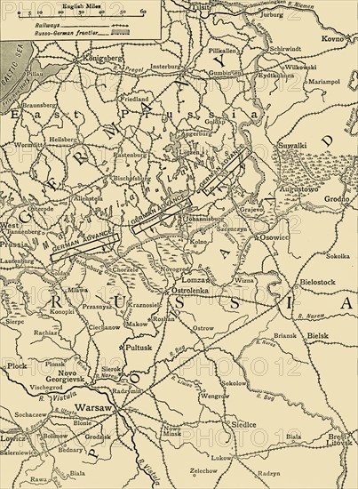
'Sketch Map to Illustrate the German Attack north of Warsaw in February, 1915', (c1920). Creator: Unknown.
Légende
'Sketch Map to Illustrate the German Attack north of Warsaw in February, 1915', (c1920). Map showing German positions near the Russo-German frontier during the First World War. From "The Great World War - A History" Volume II, edited by Frank A Mumby. [The Gresham Publishing Company Ltd, London, c1920]
Date
1914
Crédit
Photo12/Heritage Images/The Print Collector
Notre référence
HRM19F26_035
Model release
NA
Property release
NA
Licence
Droits gérés
Format disponible
60,6Mo (3,6Mo) / 33,4cm x 45,5cm / 3940 x 5374 (300dpi)