Sujet
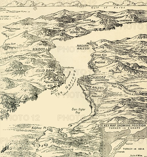
Map of the Dardanelles, First World War, 1915, (c1920). Creator: Unknown.
Légende
Map of the Dardanelles, First World War, 1915, (c1920). 'Bird's-eye View' of the Dardanelles from the Entrance to the Straits to the Narrows'. From "The Great World War - A History" Volume III, edited by Frank A Mumby. [The Gresham Publishing Company Ltd, London, c1920]
Date
1915
Crédit
Photo12/Heritage Images/The Print Collector
Notre référence
HRM19F26_036
Model release
NA
Property release
NA
Licence
Droits gérés
Format disponible
63,0Mo (5,2Mo) / 38,5cm x 41,0cm / 4542 x 4846 (300dpi)