Sujet
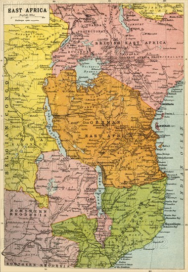
Map of East Africa, First World War, (c1920). Creator: John Bartholomew & Son.
Légende
Map of East Africa, First World War, (c1920). Map showing colonial possessions including the Belgian Congo, British East Africa, German East Africa, Northern Rhodesia and Portuguese East Africa. From "The Great World War - A History" Volume III, edited by Frank A Mumby. [The Gresham Publishing Company Ltd, London, c1920]
Date
1915
Crédit
Photo12/Heritage Images/The Print Collector
Notre référence
HRM19F26_043
Model release
NA
Property release
NA
Licence
Droits gérés
Format disponible
61,7Mo (6,8Mo) / 32,7cm x 47,3cm / 3863 x 5586 (300dpi)