Sujet
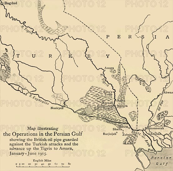
'Map illustrating the Operations in the Persian Gulf', First World War, 1915, (c1920). Creator: Unknown.
Légende
'Map illustrating the Operations in the Persian Gulf', First World War, 1915, (c1920). '...showing the British oil pipe guarded against the Turkish attacks and the advance up the Tigris to Amara, January - June 1915'. From "The Great World War - A History" Volume III, edited by Frank A Mumby. [The Gresham Publishing Company Ltd, London, c1920]
Date
1915
Crédit
Photo12/Heritage Images/The Print Collector
Notre référence
HRM19F26_045
Model release
NA
Property release
NA
Licence
Droits gérés
Format disponible
61,7Mo (2,1Mo) / 39,5cm x 39,1cm / 4668 x 4620 (300dpi)