Sujet
Map of Sari Bair, Gallipoli peninsula, First World War, 1915, (c1920). Creator: Unknown.
Légende
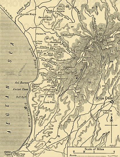
Map of Sari Bair, Gallipoli peninsula, First World War, 1915, (c1920). 'The Battlefields of Anzac: The elaborate series of operations in August, 1915, began with holding attacks on Lone Pine, German Officer's Trench, and Baby 700 Trench, and culminated in the main assaults on the Sari Bair heights'. The Battle of Sari Bair was the final attempt by the British to seize control of the Gallipoli peninsula, in Turkey, from the Ottoman Empire. From "The Great World War - A History" Volume IV, edited by Frank A Mumby. [The Gresham Publishing Company Ltd, London, c1920]
Date
1915
Crédit
Photo12/Heritage Images/The Print Collector
Notre référence
HRM19F26_099
Model release
NA
Property release
NA
Licence
Droits gérés
Format disponible
63,4Mo (5,0Mo) / 34,8cm x 45,6cm / 4116 x 5381 (300dpi)