Sujet
'Physical Map of the Ottoman Empire', c1915. Creator: Unknown.
Légende
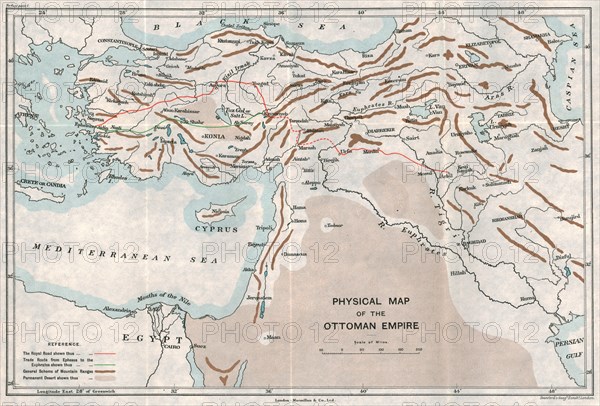
'Physical Map of the Ottoman Empire', c1915. Map showing the eastern Mediterranean, Cyprus, the Middle East, the rivers Tigris and Euphrates, what is now Turkey, and part of Egypt. Also shown are the 'Royal Road', trade routes, mountain ranges and deserts. From "The Caliphs' Last Heritage, a short history of the Turkish Empire" by Lt.-Col. Sir Mark Sykes. [Macmillan & Co, London, 1915]
Date
1915
Crédit
Photo12/Heritage Images/The Print Collector
Notre référence
HRM19F27_029
Model release
NA
Property release
NA
Licence
Droits gérés
Format disponible
47,5Mo (5,6Mo) / 41,9cm x 28,4cm / 4950 x 3353 (300dpi)