Sujet
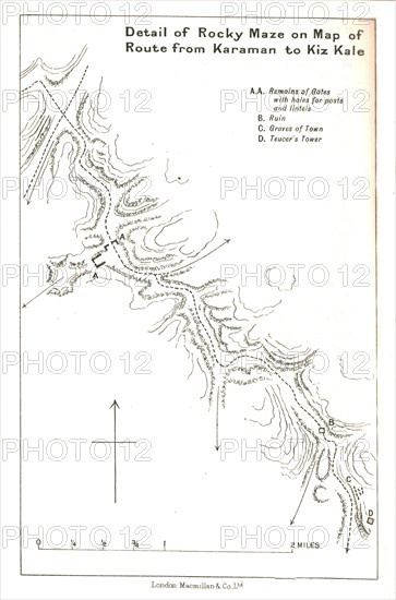
'Detail of Rocky Maze on Map of Route from Karaman to Kiz Kale', c1915. Creator: Stanford's Geographical Establishment.
Légende
'Detail of Rocky Maze on Map of Route from Karaman to Kiz Kale', c1915. Map showing part of the journey of British writer, soldier and diplomatic advisor Mark Sykes between Karaman (in Central Anatolia) and Kizkalesi on the coast of the Mediterranean in Turkey, (at that time part of the Ottoman Empire). Features marked include remains of gates, ruins, graves and 'Teucer's Tower'. Sykes (1879-1919) travelled through Palestine, Iraq, Syria, Persia and Turkey between 1905 and 1913, was honorary attaché to the British Embassy in Constantinople 1905-1906, was elected to parliament, worked in the Intelligence department of the War Office during the First World War, and died of the Spanish flu aged 39. From "The Caliphs' Last Heritage, a short history of the Turkish Empire" by Lt.-Col. Sir Mark Sykes. [Macmillan & Co, London, 1915]
Date
1915
Crédit
Photo12/Heritage Images/The Print Collector
Notre référence
HRM19F27_051
Model release
NA
Property release
NA
Licence
Droits gérés
Format disponible
47,5Mo (1,1Mo) / 28,0cm x 42,4cm / 3312 x 5013 (300dpi)