Sujet
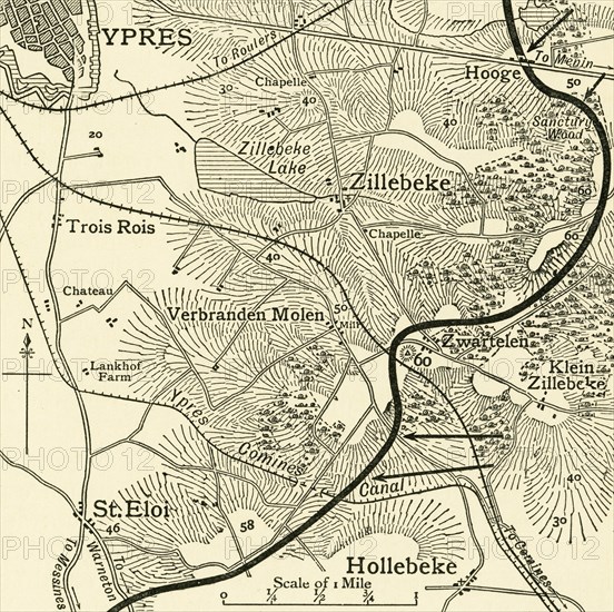
'Map showing the Scene of the German Attacks...First World War, February 1916, (c1920). Creator: Unknown.
Légende
'Map showing the Scene of the German Attacks East and South-east of Ypres, [Belgium], First World War, February 1916, (c1920). 'The "Bluff" and International Trench lie on the wooded hill north of the Ypres-Comines Canal and south of Hill 60'. From "The Great World War: A History", Volume V, edited by Frank A Mumby. [The Gresham Publishing Company Ltd, London, c1920]
Date
1916
Crédit
Photo12/Heritage Images/The Print Collector
Notre référence
HRM19F27_320
Model release
NA
Property release
NA
Licence
Droits gérés
Format disponible
63,3Mo (6,6Mo) / 39,9cm x 39,7cm / 4716 x 4691 (300dpi)