Sujet
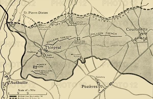
'Map showing approximately the area gained on the Thiepval Ridge...1916', (c1920). Creator: Unknown.
Légende
'Map showing approximately the area gained on the Thiepval Ridge between September 14 and October 31, 1916', (c1920). The British line in northern France during the Battle of the Somme, First World War. From "The Great World War: A History", Volume VI, edited by Frank A Mumby. [The Gresham Publishing Company Ltd, London, c1920]
Date
1916
Crédit
Photo12/Heritage Images/The Print Collector
Notre référence
HRM19F27_380
Model release
NA
Property release
NA
Licence
Droits gérés
Format disponible
61,2Mo (3,5Mo) / 48,7cm x 31,5cm / 5754 x 3718 (300dpi)