Sujet
'Map illustrating the Operations at Verdun', First World War, August-November, 1917, (c1920). Creator: Unknown.
Légende
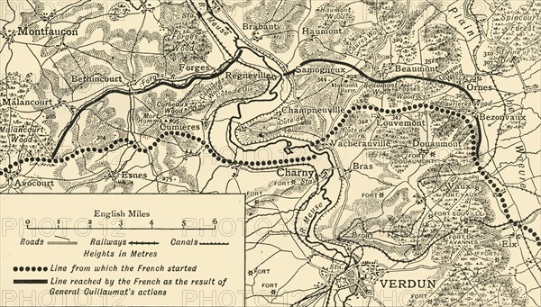
'Map illustrating the Operations at Verdun', First World War, August-November, 1917, (c1920). Map of the area around the town of Verdun in northern France, showing 'Line from which the French started', and 'Line reached by the French as the result of General [Adolphe] Guillaumat's actions'. From "The Great World War: A History", Volume VII, edited by Frank A Mumby. [The Gresham Publishing Company Ltd, London, c1920]
Date
1917
Crédit
Photo12/Heritage Images/The Print Collector
Notre référence
HRM19F27_432
Model release
NA
Property release
NA
Licence
Droits gérés
Format disponible
63,4Mo (5,9Mo) / 52,8cm x 30,1cm / 6236 x 3552 (300dpi)