Sujet
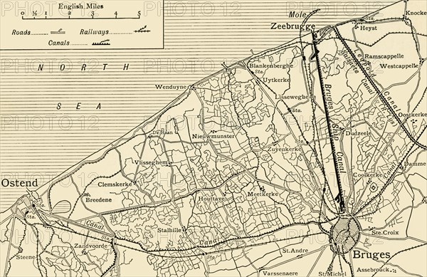
'Map showing the Canal System connecting Zeebrugge and Ostend with Bruges'...(c1920). Creator: Unknown.
Légende
'Map showing the Canal System connecting Zeebrugge and Ostend with Bruges', First World War, (c1920). The Belgian ports of Ostend and Zeebrugge were connected to the city of Bruges via canals. From "The Great World War: A History", Volume IX, edited by Frank A Mumby. [The Gresham Publishing Company Ltd, London, c1920]
Date
1914
Crédit
Photo12/Heritage Images/The Print Collector
Notre référence
HRM19F27_454
Model release
NA
Property release
NA
Licence
Droits gérés
Format disponible
61,0Mo (4,6Mo) / 48,6cm x 31,5cm / 5736 x 3720 (300dpi)