Sujet
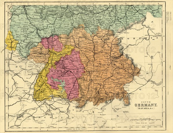
Map of South Germany and Bavaria, c1872. Creator: Unknown.
Légende
Map of South Germany and Bavaria, c1872. 'The territories colored green form part of the North German Confederation'. Also showing Luxembourg, part of Prussia, the Palatinate of Bavaria, Hesse, Baden, Hohenzollern and Wurtemberg. From "The Franco-Prussian War: its causes, incidents and consequences", Volume I, by Captain H M Hozier. [William Mackenzie, London, 1872]
Crédit
Photo12/The Print Collector
Notre référence
HRM19G31_434
Model release
NA
Property release
NA
Licence
Droits gérés
Format disponible
63,1Mo (7,3Mo) / 45,3cm x 34,9cm / 5351 x 4119 (300dpi)