Sujet
Map of the Battle of Woerth, 6 August 1870, (c1872). Creator: R. Walker.
Légende
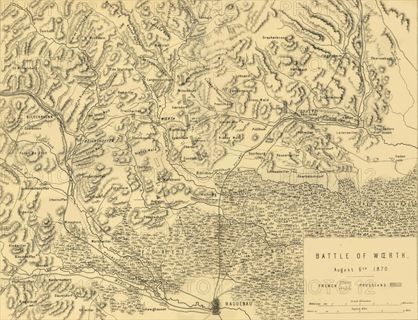
Map of the Battle of Woerth, 6 August 1870, (c1872). Map: 'Drawn under the Superintendance of Captain Hozier', showing the enemy positions. The second Battle of Wörth, also known as the Battle of Reichshoffen or the Battle of Froeschwiller, took place near the village of Woerth in Alsace (in France), in the opening stages of the Franco-Prussian War of 1870-1871. From "The Franco-Prussian War: its causes, incidents and consequences", Volume I, by Captain H M Hozier. [William Mackenzie, London, 1872]
Crédit
Photo12/The Print Collector
Notre référence
HRM19G32_003
Model release
NA
Property release
NA
Licence
Droits gérés
Format disponible
62,5Mo (4,0Mo) / 45,2cm x 34,7cm / 5337 x 4094 (300dpi)