Sujet
'Map to Illustrate Operations by Orleans', (c1872). Creator: R. Walker.
Légende
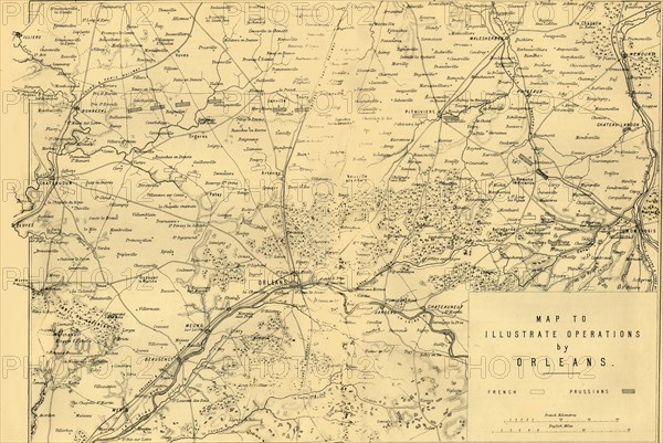
'Map to Illustrate Operations by Orleans', (c1872). Map: 'Drawn under the Superintendence of Captain Hozier', showing the enemy positions. During the Second Battle of Orléans which took place on 3 and 4 December 1870, the Germans recaptured the town of Orléans in northern France. From "The Franco-Prussian War: its causes, incidents and consequences", Volume II, by Captain H M Hozier. [William Mackenzie, London, 1872]
Crédit
Photo12/The Print Collector
Notre référence
HRM19G32_022
Model release
NA
Property release
NA
Licence
Droits gérés
Format disponible
45,1Mo (5,0Mo) / 41,1cm x 27,5cm / 4858 x 3248 (300dpi)