Sujet
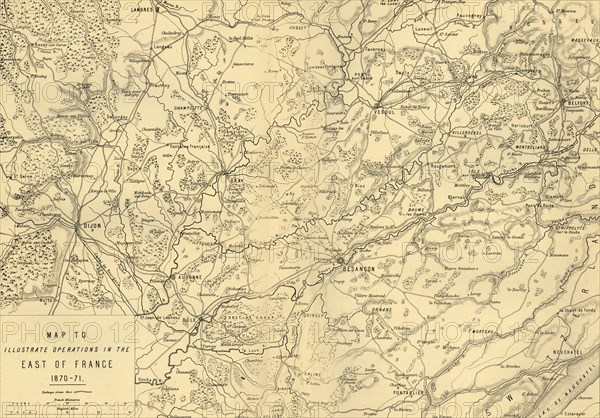
'Map to Illustrate Operations in the East of France 1870-71', c1872. Creator: R. Walker.
Légende
'Map to Illustrate Operations in the East of France 1870-71', (c1872). Map: 'Drawn under the Superintendence of Captain Hozier', showing the towns of Dijon and Besançon. From "The Franco-Prussian War: its causes, incidents and consequences", Volume II, by Captain H M Hozier. [William Mackenzie, London, 1872]
Crédit
Photo12/The Print Collector
Notre référence
HRM19G32_026
Model release
NA
Property release
NA
Licence
Droits gérés
Format disponible
62,9Mo (6,5Mo) / 47,5cm x 33,2cm / 5616 x 3916 (300dpi)