Sujet
'Matthew Paris's Map of Great Britain, c.1250', (1944). Creator: Matthew Paris.
Légende
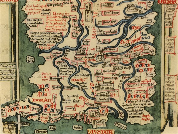
Matthew Paris's Map of Great Britain, c.1250', (1944). Detail showing rivers and towns in the south of England and part of Wales. Many place-names are still recognisable today. The word 'Auster', written over the English Channel at the bottom, refers to wind bringing heavy cloud cover and fog. Map drawn by the historian Matthew Paris, a monk at St Alban?s Abbey. Cotton MS Claudius D.vi, f.12v, manuscrit in the British Library, London. From "British Maps and Map-Makers", by Edward Lynam. [Collins, London, 1944]
Crédit
Photo12/The Print Collector
Notre référence
HRM19G32_465
Model release
NA
Property release
NA
Licence
Droits gérés
Format disponible
62,6Mo (3,9Mo) / 45,5cm x 34,5cm / 5375 x 4072 (300dpi)