Sujet
Map of the British Isles, 1946. Creator: Unknown.
Légende
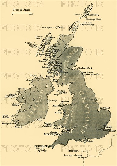
Map of the British Isles, 1946. Map of England, Wales, Ireland and Scotland, 'Showing the Chief Places Mentioned in the Text', ie islands off the coast including Holy Island, the Farne Islands, Mersea, Canvey and Sheppey, Isle of Wight, Isles of Scilly, Lundy, Skomer, Anglesey, the Skerries, Isle of Man, Great Blasket, the Outer Hebrides, the Orkneys and the Shetlands. From "Islands Round Britain", by R. M. Lockley. [Collins, London, 1946]
Crédit
Photo12/The Print Collector
Notre référence
HRM19G32_480
Model release
NA
Property release
NA
Licence
Droits gérés
Format disponible
61,9Mo (1,8Mo) / 33,0cm x 47,0cm / 3900 x 5550 (300dpi)