Sujet
The Isle of Wight, 1844. Creator: Unknown.
Légende
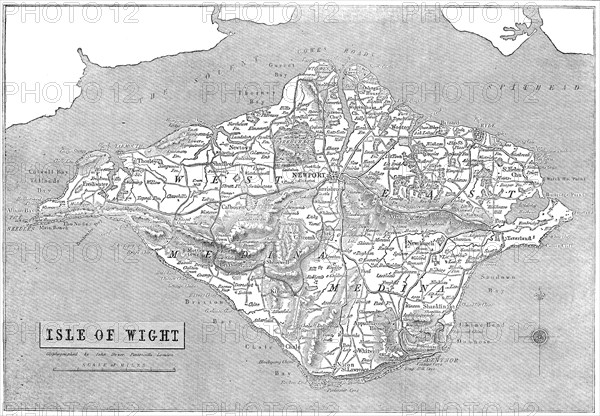
The Isle of Wight, 1844. Map of the Isle of Wight, off the south coast of England, made using 'Mr. Palmer's patent Giyphographic process, or Engraved Drawing'. 'The Isle of Wight is situated in the English Channel, at a short distance from the mainland of Hampshire, of which county it has commonly been reckoned a part. The channel which divides it from the grand line of our southern coast, varies in width from two to six miles, and bears the appellation of the Solent Sea. The form of the island is irregular, but bears a rude resemblance to that of the heraldic lozenge'. From "Illustrated London News", 1844, Vol V.
Crédit
Photo12/Heritage Images/The Print Collector
Notre référence
HRM21A06_243
Model release
NA
Property release
NA
Licence
Droits gérés
Format disponible
48,9Mo (4,3Mo) / 42,0cm x 29,2cm / 4960 x 3446 (300dpi)