Sujet
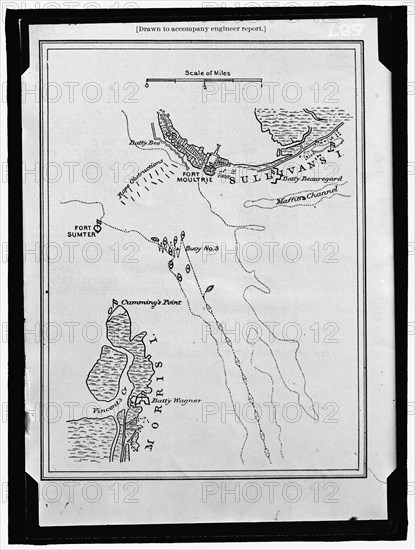
Map showing Fort Sumter and Fort Moultrie, between 1909 and 1914. Creator: Harris & Ewing.
Légende
Map showing Fort Sumter and Fort Moultrie, between 1909 and 1914. 'Drawn to accompany engineer report'. Battle site, Charleston Harbour, South Carolina: Battery Bee, rope obstructions, Sullivan's Island, Maffitt's Channel, buoys, Cumming's Point, Vincent's Creek, Morris Island, Battery Wagner.
Crédit
Photo12/Heritage Images/Heritage Art
Notre référence
HRM22B06_201
Model release
NA
Property release
NA
Licence
Droits gérés
Format disponible
226,7Mo (5,1Mo) / 65,5cm x 86,7cm / 7741 x 10235 (300dpi)