Sujet
The Coast North of Sebastopol, and New Earth Batteries, 1854. Creator: Unknown.
Légende
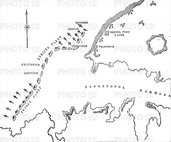
The Coast North of Sebastopol, and New Earth Batteries, 1854. Crimean War. Map of the strategic Black Sea port, '...sketched on board H.M.S. "Spitfire" for the Admiralty [showing] the position of the Allied fleets during the bombardment on the batteries, Oct. 17'. The French and English fleets are ranged across the entrance to the harbour. The shaded areas indicate Russian defensive positions. Also marked are the Square Fort and guns. From "Illustrated London News", 1854.
Crédit
Photo12/Heritage Images/The Print Collector
Notre référence
HRM22B07_142
Model release
NA
Property release
NA
Licence
Droits gérés
Format disponible
12,7Mo (263,8Ko) / 19,5cm x 16,3cm / 2309 x 1924 (300dpi)