Sujet
Map of India, 1857. Creator: Unknown.
Légende
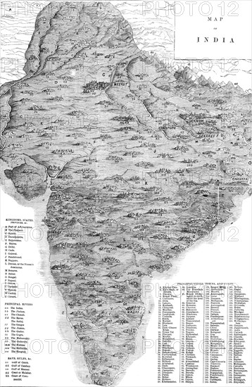
Map of India, 1857. Map of the Indian subcontinent during the British colonial period, showing 'Kingdoms, States, Provinces &c...Principal Rivers...Bays, Gulfs &c...Principal Cities, Towns, and Forts'. From "Illustrated London News", 1857.
Crédit
Photo12/Heritage Images/The Print Collector
Notre référence
HRM23A76_407
Model release
NA
Licence
Droits gérés
Format disponible
61,9Mo (4,3Mo) / 31,8cm x 48,8cm / 3755 x 5758 (300dpi)