Sujet
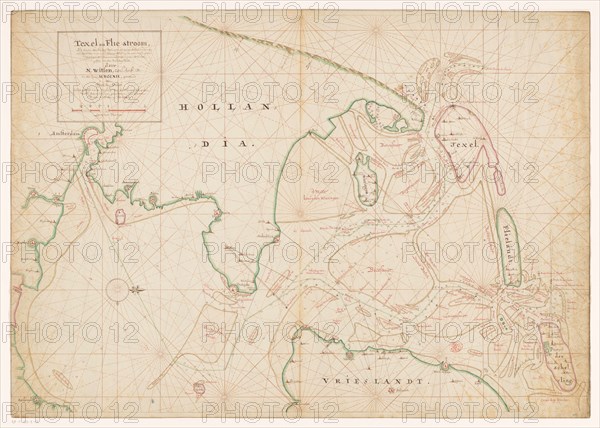
Map of Noord-Holland, Texel, Vlieland, Terschelling, part of Friesland..., 1712. Creator: Isaak de Graaf.
Légende
Map of Noord-Holland, Texel, Vlieland, Terschelling, part of Friesland and the surrounding sandbanks, 1712. Top left, cartouche with the title 'Texel en Flie-stroom' (Texel and the Flie-stream) and a scale: Duytze Mylen. Orientation: north on the right.
Crédit
Photo12/Heritage Images/Heritage Art
Notre référence
HRM23A85_202
Model release
NA
Property release
NA
Licence
Droits gérés
Format disponible
82,9Mo (4,0Mo) / 53,9cm x 38,5cm / 6366 x 4550 (300dpi)