Sujet
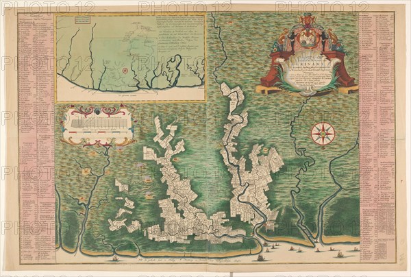
General map of Suriname, 1737-1757. Creator: Hendrik de Leth.
Légende
General map of Suriname, 1737-1757. 'Map of the colony or province of Suriname: with the rivers, districts, discoveries by military expeditions and the size of the measured plantations / by burden'. Two sheets stuck together, showing the plantations on the various rivers. Left and right: columns with the names of the owners of the plantations, a total of 519. In the top left: map of the wider area. Left: Cartouche with the scale. At the top right: Cartouche with the title and the coat of arms of Suriname. (Surinam, also unofficially known as Dutch Guiana, was a Dutch plantation colony in South America).
Crédit
Photo12/Heritage Images/Heritage Art
Notre référence
HRM23A86_326
Model release
NA
Property release
NA
Licence
Droits gérés
Format disponible
130,3Mo (9,7Mo) / 69,6cm x 46,9cm / 8216 x 5544 (300dpi)