Sujet
Map of the area between Bergen op Zoom and Steenbergen, 1630. Creator: Franciscus van Schooten.
Légende
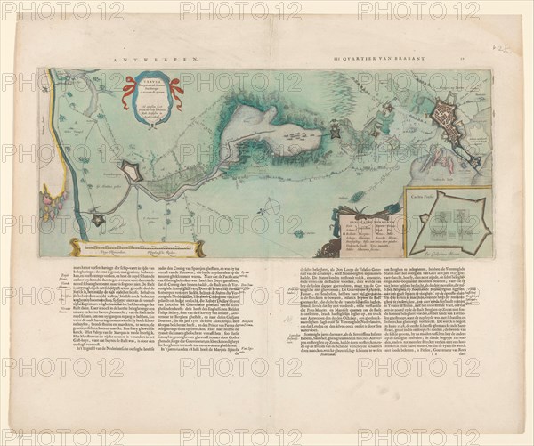
Map of the area between Bergen op Zoom and Steenbergen, 1630. 'Tabula Bergarum ad Zomam Stenbergae'. Showing fortresses, trees, hills, harbours, areas susceptible to flooding, roads and agricultural land. Bottom left, scale in Rhineland rods. Bottom right inset, map of a fortress, Castra Pinsii.
Crédit
Photo12/Heritage Images/Heritage Art
Notre référence
HRM23A87_282
Model release
NA
Property release
NA
Licence
Droits gérés
Format disponible
69,9Mo (3,8Mo) / 45,8cm x 38,3cm / 5404 x 4520 (300dpi)