Sujet
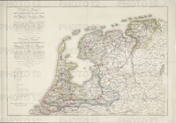
Nouvelle Carte des Sept Departemens de la Hollande/ New map of the seven Dutch...(1811-1812). Creator: Jan Gerritsz. Visser.
Légende
Nouvelle Carte des Sept Departemens de la Hollande (...) / New map of the seven Dutch departments. Divided pursuant to the decree of his Majesty the Emperor and King of October 21, 1811, introduced with the year 1812, (1811-1812). Map of new classification of the Netherlands. On the left, extensive titles in French and Dutch, key to the symbols used.
Crédit
Photo12/Heritage Images/Heritage Art
Notre référence
HRM23A88_142
Model release
NA
Property release
NA
Licence
Droits gérés
Format disponible
117,0Mo (8,0Mo) / 64,8cm x 45,2cm / 7652 x 5344 (300dpi)