Sujet
Map of the southern (Austrian) Netherlands, 1719. Creator: Joachim Ottens.
Légende
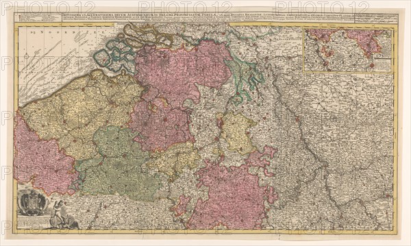
Map of the southern (Austrian) Netherlands, 1719. 'Novissima et accuratissima decem Austriacarum in Belgio provinciarum tabula, ut sunt ducatus Brabantiae, Luxembergensis, Limburgensis, et Geldriae, comitatus Flandriae'. Inset top right: part of the Duchy of Luxembourg; scale in German, Spanish and English-French miles. Bottom left: dedication to Emperor Charles VI with his coat of arms and a putto fighting a harpy.
Crédit
Photo12/Heritage Images/Heritage Art
Notre référence
HRM23A88_232
Model release
NA
Property release
NA
Licence
Droits gérés
Format disponible
102,0Mo (9,1Mo) / 65,3cm x 39,1cm / 7716 x 4620 (300dpi)