Sujet
Map of North Holland, c.1700-c.1710. Creator: Nicolaes Visscher.
Légende
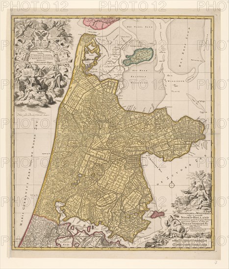
Map of North Holland, c.1700-c.1710. 'Kennemaria et Westfrisia vulgo et vernaculé Noord-Holland tam in minores quam Praecipuas Ditiones...'. Showing the southern tip of Texel, Wieringen, Marken and a small section of South Holland. At the bottom right scale in German and French miles (1: 150,000). At the bottom right the title, farmers with cheeses, butter and milk. At top left, dedication and putti with the imperial crown and coat of arms, allegorical figures - one holding a windmill looking at an image of a lock.
Crédit
Photo12/Heritage Images/Heritage Art
Notre référence
HRM23A89_098
Model release
NA
Property release
NA
Licence
Droits gérés
Format disponible
75,9Mo (6,1Mo) / 40,2cm x 47,3cm / 4748 x 5584 (300dpi)