Sujet
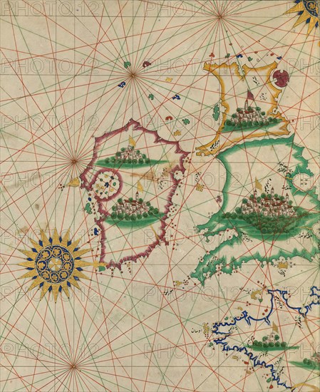
Map of Britain and Ireland, 10th century AH/AD 16th century. Creator: Unknown.
Légende
Map of Britain and Ireland, 10th century AH/AD 16th century. Page from an early Ottoman illuminated and illustrated maritime atlas, referred to as the Walters Deniz atlasi. The work contains 8 double-page charts executed on parchment. The various geographical names are written in black Nasta'liq script. A distinguishing feature of this atlas is the detailed approach to representing such features as city vignettes.
Crédit
Photo12/Heritage Images/Heritage Art
Notre référence
HRM23B15_243
Model release
NA
Property release
NA
Licence
Droits gérés
Format disponible
57,6Mo (2,7Mo) / 34,3cm x 42,0cm / 4056 x 4960 (300dpi)