Sujet
Topographical sketch of the gold & quicksilver district of California, 1848. Creator: Edward Ord.
Légende
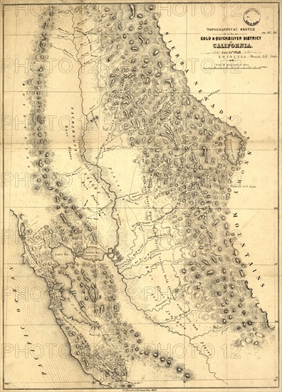
Topographical sketch of the gold & quicksilver district of California, 1848. Published in July 1848 after the first gold strikes at Sutter's Mill on the American River in northern California, this map shows the location of key gold and quicksilver (mercury, in the form of cinnabar) deposits in the territory of California. Soon after the find, prospectors began streaming into California in enormous numbers, and demand was high for geographic knowledge of the region, especially as it related to previous strikes. The map displays the basic topography of California by showing mountains, rivers, bays, and mountain passes, but its main purpose is to highlight the latest information on mineral deposits and the exact locations where gold and quicksilver had been discovered. The cartographer was Edward Otho Cresap Ord (1818-83), a Union general in the American Civil War, and the map was printed by Peter S. Duval (circa 1805-86), a leading Philadelphia lithographer.
Crédit
Photo12/Heritage Images/Heritage Art
Notre référence
HRM24A00_031
Model release
NA
Property release
NA
Licence
Droits gérés
Format disponible
88,1Mo (8,1Mo) / 39,9cm x 55,3cm / 4708 x 6537 (300dpi)