Sujet
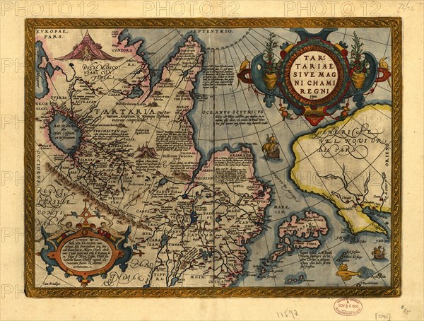
Tartariae Sive Magni Chami Regni typus, 1603. Creators: Abraham Ortelius, Jan Baptist Vrients.
Légende
Tartariae Sive Magni Chami Regni typus, 1603. From Abraham Ortelius's atlas: Theatrvm Orbis Terrarvm, 1603 ed. Hand col. Includes text, notes, and col. ill. Text on verso. Abraham Ortelius' map of Tartary, Japan, and the west coast of North America, from Ortelius' Theatrum Orbis Terarrum, the first modern atlas of the world. This map is the earliest obtainable map to name California and is one of the first to include the Strait of Anian, which separates North America and Asia. It provides a remarkable representation of what was then the Tartar Kingdom, extending from the Caspian Sea in the west, to China, Japan and Russia in the east.
Crédit
Photo12/Heritage Images/Heritage Art
Notre référence
HRM24A00_032
Model release
NA
Property release
NA
Licence
Droits gérés
Format disponible
85,5Mo (6,9Mo) / 53,2cm x 40,3cm / 6279 x 4758 (300dpi)