Sujet
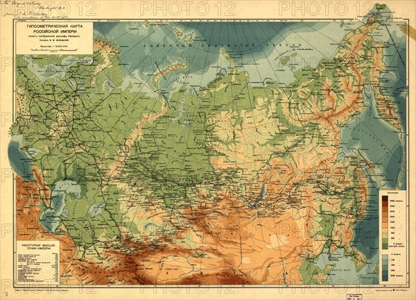
Gypsometric map of the Rossiiskoi Empire:(an educational report on the Rossiiskoi Empire), (1912?) Creator: Unknown.
Légende
Gypsometric map of the Rossiiskoi Empire : (an educational report on the Rossiiskoi Empire), (1912?). Relief and depths shown by gradient tints. Also shows railroads. In Russian. Pulkovo (St. Petersburg) meridian. Includes table of extreme high elevations.
Crédit
Photo12/Heritage Images/Heritage Art
Notre référence
HRM24A00_077
Model release
NA
Property release
NA
Licence
Droits gérés
Format disponible
145,3Mo (12,5Mo) / 71,1cm x 51,2cm / 8397 x 6048 (300dpi)