Sujet
Crooked Reach, Strait of Magellan, 1869. Creator: Unknown.
Légende
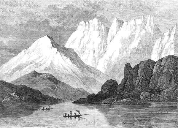
Crooked Reach, Strait of Magellan, 1869. Engraving of a sketch by '...Mr. F. L. Bedwell, of the Admiralty Surveying Department, who was lately engaged in the exploration of these parts by H. M. S. Nassau... This very intricate series of channels, forming a communication between the Atlantic and Pacific Oceans, has a total length of more than 300 miles, and varies in width from 15 miles at the eastern entrance, between Cape Virgins and Cape Espirito Santo, to 50 miles in the middle portion of its course...These islands are deeply penetrated by inlets of the sea, which are overlooked by high mountains of clay slate, greenstone, and granite, crowned with perpetual snows, and sending down huge glaciers of blue ice almost to the seacoast; the lower slopes and valleys are densely covered with forests of stunted beech-trees, growing out of the swampy peat-soil, but in sheltered spots there is a variety of wild vegetation. The climate is cold and rainy, with frequent storms and occasional thick fogs, which make the navigation difficult and perilous. The tides rise to a height of 50 ft. in the Strait of Magellan'. From "Illustrated London News", 1869.
Crédit
Photo12/Heritage Images/The Print Collector
Notre référence
HRM24A34_217
Model release
NA
Property release
NA
Licence
Droits gérés
Format disponible
28,4Mo (2,3Mo) / 31,4cm x 22,6cm / 3710 x 2671 (300dpi)