Sujet
Plan of the Amsterdam Ship Canal, 1870. Creator: Unknown.
Légende
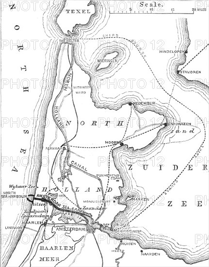
Plan of the Amsterdam Ship Canal, 1870. Map of '...the great canal for seagoing ships which is still under construction between the city of Amsterdam and the German Ocean [ie North Sea]. The Amsterdam Sea Canal, which is to be only fifteen miles and a half in length, will place that great commercial city in direct maritime communication with a new artificial port to be formed on the North Sea coast, near Haarlem, and just opposite the coast of Suffolk...The entire series of works has been designed and is being executed under the joint superintendence of Mr. J. Hawkshaw, C.E., and Mr. Dirks, the engineers; and Messrs. Henry Lee and Sons, of Westminster Chambers, Victoria-street, are contractors for the whole undertaking. Mr. T. C. Watson, C.E., superintends the lock and dam works on behalf of the contractors'. From "Illustrated London News", 1870.
Crédit
Photo12/Heritage Images/The Print Collector
Notre référence
HRM24A48_250
Model release
NA
Property release
NA
Licence
Droits gérés
Format disponible
55,3Mo (1,9Mo) / 33,0cm x 42,0cm / 3895 x 4959 (300dpi)