même sujet
Mtstmichel12
Sujet
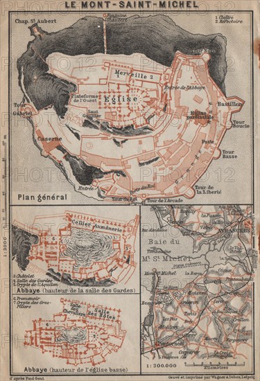
MONT-SAINT-MICHEL. Abbaye Abbey & environs plan. Manche carte, 1909 old map
Légende
'Le Mont-Saint-Michel; Abbaye (hauteur de la salle des Gardes); Abbaye (hauteur de I'église basse); Baie du Mt. St. Michel'. Artist/engraver/cartographer: Wagner & Debes. Provenance: "Northern France from Belgium and the English channel to the Loire excluding Paris and its environs"; by Karl Baedeker, Published by Karl Baedeker, London: 5th Edition . Type: Antique colour map; Scale 1:300,000.
Info+
Photographe : Antiqua Print Gallery
Date
1909
Crédit
Photo12/Alamy/Antiqua Print Gallery
Notre référence
LMY23T03_GHXXFY
Utilisation
uniquement en France
Model release
Non
Property release
Non
Licence
Libre de droits
Format disponible
6,4Mo (640,9Ko) / 10,4cm x 15,3cm / 1232 x 1804 (300dpi)