Sujet
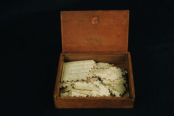
Geography puzzle in coffin: map with the Netherlands, Belgium, Luxembourg, France, Germany in 1816, jigsaw puzzle toy relaxing
Légende
Geography puzzle in coffin: map with the Netherlands, Belgium, Luxembourg, France, Germany in 1816, jigsaw puzzle toy relaxing medium wood paper, die-cut? Jigsaw puzzle in flat wooden box with sliding lid The representation concerns map on which the Netherlands Belgium and Luxembourg are colored; North Sea France and Germany are not colored and only partially displayed. The engraving has been sawn along the provincial borders of the Netherlands and Belgium; Luxembourg has been cut out as whole; France and Germany have sawn independently of the drawing. Top left drawing of an unrolled roll on which text. small scroll in the lower right corner also contains some text Text banderol upper left corner: New map of the Kingdom of the Netherlands with Covens and son and J. ten Brink G.Z. .. Amsterdam 1816 Banderol in the lower right corner: Scale of 15 German miles .. Scale of 20 hours of gait Along the bottom edge outside the map: Covens del Zurcher fe topography play Benelux Europe
Date
1816
Crédit
Photo12/Liszt Collection
Notre référence
LZT19B49_166
Model release
NA
Licence
Droits gérés
Format disponible
31,3Mo (977,8Ko) / 34,3cm x 22,9cm / 4050 x 2700 (300dpi)