Sujet
Mobile Bay 1865
Légende
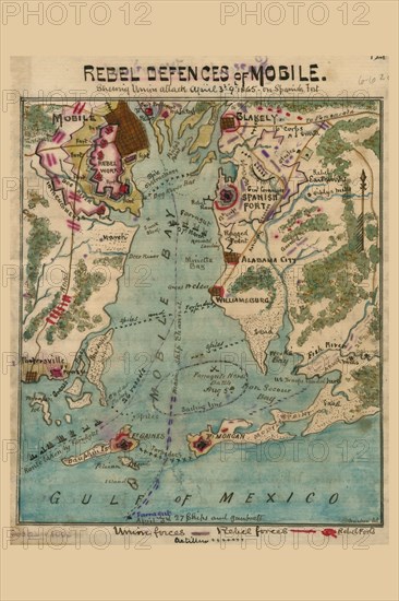
Map shows route taken by Union Admiral Farragut in August 1864 as well as that in March 1865, when his fleet provided naval support to land forces under Frederick Steele and E.R.S. Camby. Camby captured Spanish Fort and Blakely, across the bay from Mobile, entering that city on April 18. This map pays attention to the Confederates use of spikes and torpedoes (naval mines) as defenses against an invasion by water.
Crédit
Photo12/Universal Images Group
Notre référence
UMG20A00_270
Model release
NA
Property release
NA
Licence
Droits gérés
Format disponible
17,2Mo (3,0Mo) / 16,9cm x 25,4cm / 2000 x 3000 (300dpi)