Sujet
Railroad Map of the Eastern States & New England - 1856 1856
Légende
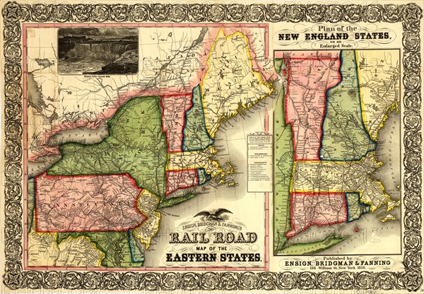
Map of New England, part of eastern Canada, New York, Pennsylvania, New Jersey, Delaware, most of Maryland, and part of Virginia. Shows drainage, some relief by hachure's, place names, and state boundaries. "Names of rail roads which are designated by numbers on the annexed 'Plan of the New England States'" appear at the right of the map.
Crédit
Photo12/Universal Images Group
Notre référence
UMG20A01_347
Model release
NA
Property release
NA
Licence
Droits gérés
Format disponible
51,6Mo (7,4Mo) / 43,2cm x 29,9cm / 5100 x 3537 (300dpi)