Sujet
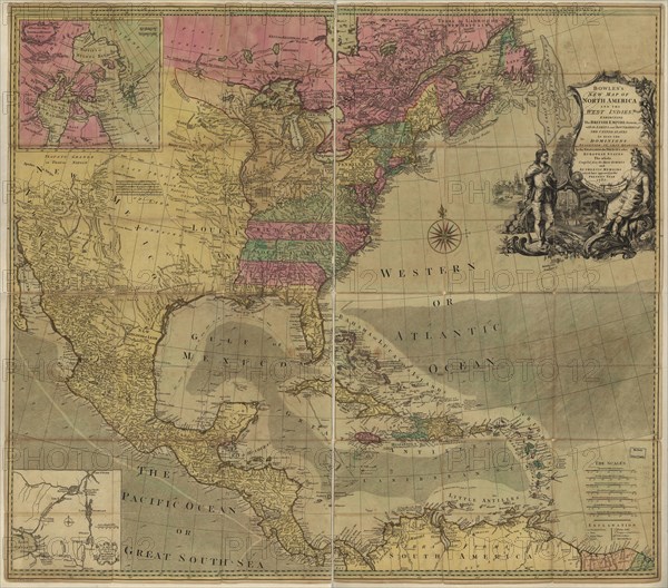
British Empire in North America - 1783 1783
Légende
Bowles's new map of North America and the West Indies, exhibiting the British Empire therein with the limits and boundaries of the United States as also the dominions possessed in that quarter, by the Spaniards, the French & other European states, the whole compiled from the best surveys and authentic memoirs which have appeared to the present year, 1783.
Crédit
Photo12/Universal Images Group
Notre référence
UMG20A01_359
Model release
NA
Property release
NA
Licence
Droits gérés
Format disponible
65,5Mo (8,2Mo) / 43,2cm x 38,0cm / 5100 x 4491 (300dpi)