Sujet
Sante Fe Route into Mexico - 1888 1888
Légende
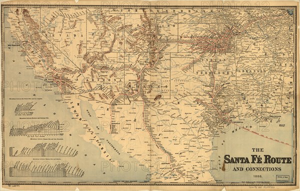
Map of the southwestern United States and northern Mexico showing relief by hachures, drainage, cities and towns, stations, Indian reservations, state boundaries, and the railroad network emphasizing the main line. Includes railroad names. Profiles in lower left of map.
Crédit
Photo12/Universal Images Group
Notre référence
UMG20A01_435
Model release
NA
Property release
NA
Licence
Droits gérés
Format disponible
47,4Mo (5,3Mo) / 43,2cm x 27,5cm / 5100 x 3249 (300dpi)