Sujet
Fort Sumter & Wagner - 1863 1863
Légende
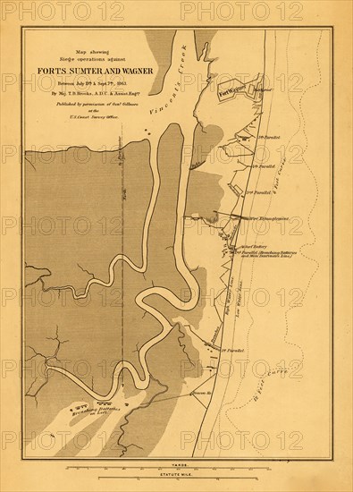
Shows drainage, roads, high and low water line, 6-ft. and 12-ft. depth curve, batteries, trenches, stockades, and a plan of Fort Wagner. Fort Sumter does not appear on this map, only the line of fire to the fort from the breaching batteries south of Fort Wagner.
Date
1863
Crédit
Photo12/Universal Images Group
Notre référence
UMG20A03_066
Model release
NA
Property release
NA
Licence
Droits gérés
Format disponible
39,1Mo (3,0Mo) / 26,5cm x 36,9cm / 3132 x 4360 (300dpi)