Sujet
Map of the southern states with insets of Lincoln, Seward, Scott & McClellan - 1861 1861
Légende
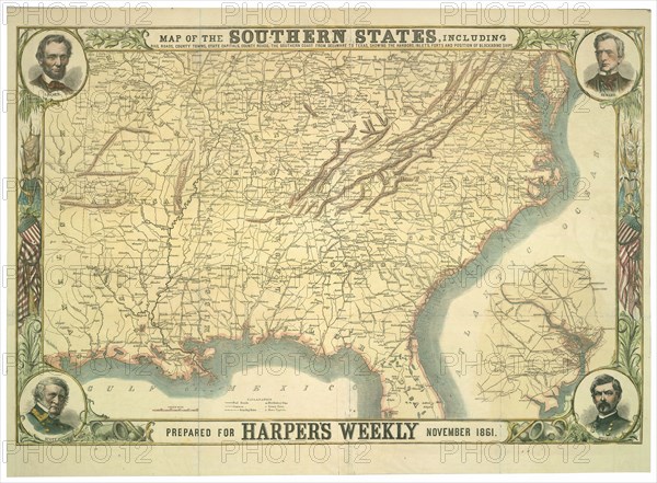
Map of the southern states, including rail roads, county towns, state capitals, county roads, the southern coast from Delaware to Texas, showing the harbors, inlets, forts, and position of blockading ships; portraits of Lincoln, Seward, Scott, and McClellan and inset map of Washington, D.C. and environs.
Crédit
Photo12/Universal Images Group
Notre référence
UMG20A03_088
Model release
NA
Property release
NA
Licence
Droits gérés
Format disponible
190,2Mo (10,0Mo) / 80,5cm x 59,2cm / 9508 x 6992 (300dpi)