Sujet
Political Map of the united States - 1856 1856
Légende
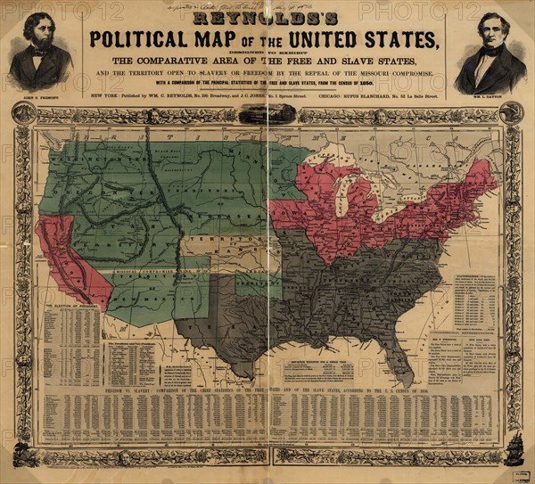
comparative area of the free and slave states and the territory open to slavery or freedom by the repeal of the Missouri Compromise. Portraits of Fremont & Dayton
Crédit
Photo12/Universal Images Group
Notre référence
UMG20A03_136
Model release
NA
Property release
NA
Licence
Droits gérés
Format disponible
158,8Mo (5,9Mo) / 66,3cm x 60,0cm / 7828 x 7090 (300dpi)